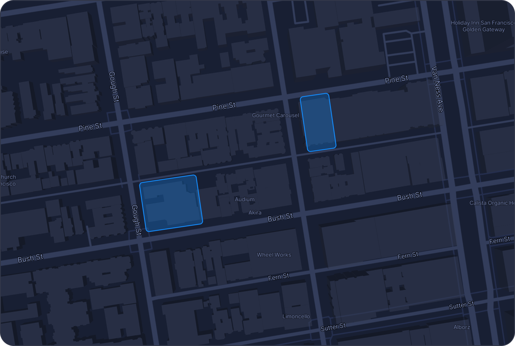


Identifying Properties with Poor Roof Conditions in San Francisco
Challenge
Identifying properties with poor roof conditions can be crucial for roofing repair companies, buyers, sellers, and insurers.
Solution
GeoLava leverages satellite imagery, UAV data, and machine learning algorithms to detect signs of roof deterioration, such as missing shingles, water damage, and structural weaknesses. By simply typing a query, GeoLava provides a detailed analysis and visual representation of properties with poor roof conditions, helping you make informed decisions.
Prompt example
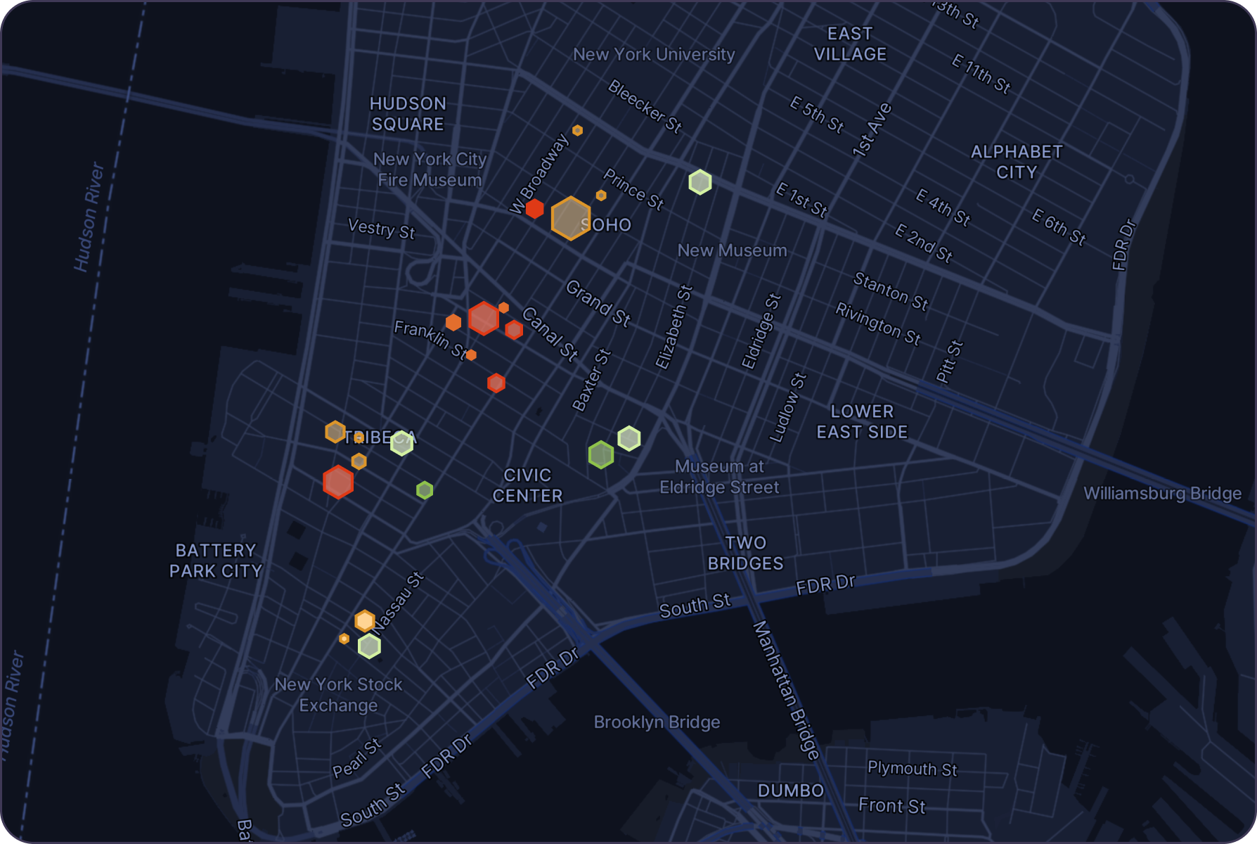
Environmental Hazard Risk for Manhattan Properties Near Industrial Sites
Challenge
Properties in Manhattan near industrial zones face increased risks from environmental hazards such as pollution and chemical spills, which can lead to significant liability and property damage
Solution
Geolava assesses proximity to industrial facilities, historical environmental incidents, and the presence of hazardous materials nearby, providing insurers with critical insights to evaluate environmental risks and prevent costly liabilities.
Prompt example
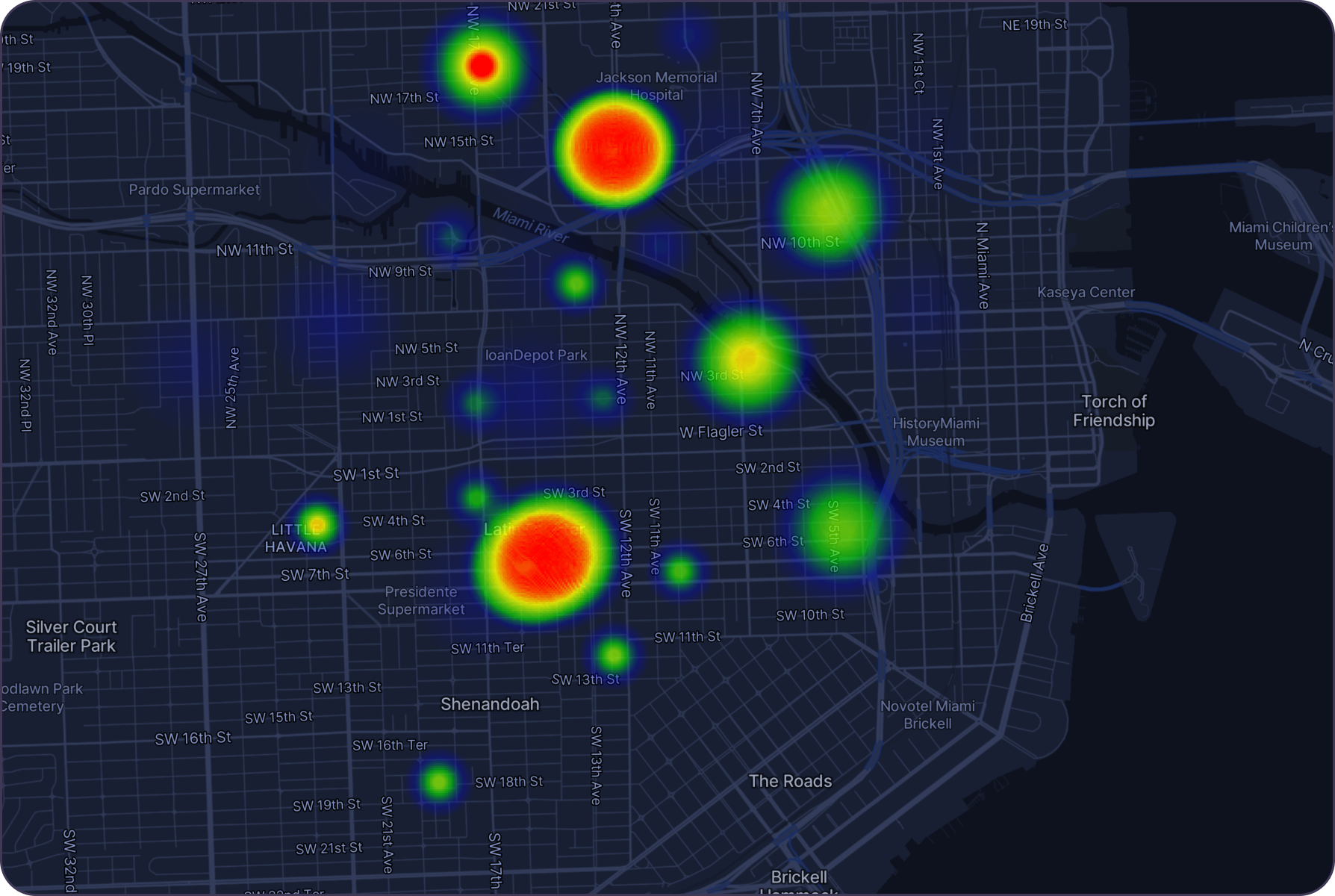
Damage Risk Assessment for Properties Impacted by Hurricane Helen
Challenge
Hurricane Helen caused widespread wind damage, exposing vulnerabilities in properties located in high-risk areas.
Solution
Geolava analyzes over 100+ risk factors, including geographic location, wind mitigation features, and surrounding terrain, helping insurers assess storm risks and improve underwriting.
Prompt example
Why choose GeoLava?
Instant Insights
Get real-time analysis and visualization of geospatial data with just a query.
Comprehensive Data
Access a wide range of data sources, including satellite imagery, UAV data, and social media.
User-Friendly Interface
The intuitive platform is designed for users of all technical levels.
Actionable Intelligence
Make informed decisions with data-driven insights tailored to your needs.
Experience the future of geospatial intelligence with GeoLava. Start your journey today and see how our AI-powered platform can transform your business operations.